

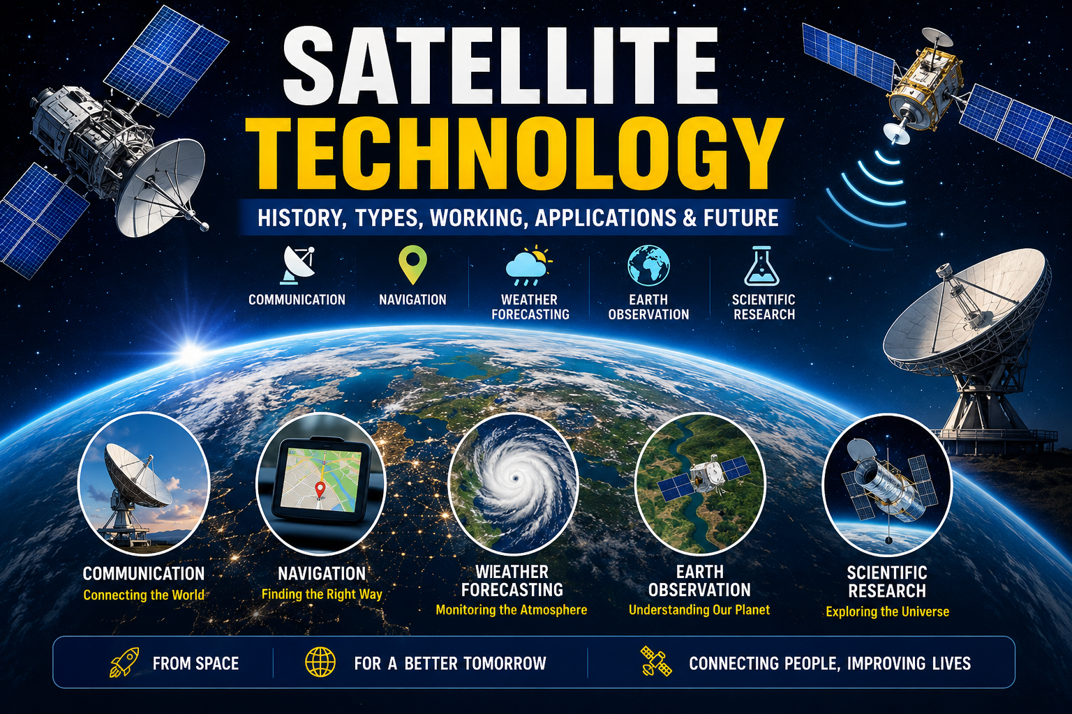
Satellites: Complete Guide to Artificial Satellites, Their History(1687-2026), Types, Working Principle, Applications, and Future

Introduction
Satellites have transformed modern civilization by making global communication, navigation, weather forecasting, scientific research, environmental monitoring, and space exploration possible. Every day, billions of people unknowingly rely on satellites while making phone calls, using GPS navigation, watching television, browsing the internet, conducting financial transactions, or checking the weather.
A satellite is any object that revolves around another larger object due to gravity. While the Moon is Earth’s natural satellite, thousands of artificial satellites have been launched into space to perform various scientific, commercial, military, and communication tasks.
Today, satellites play a critical role in connecting the world and advancing technology. This article explores everything about satellites—from their history and types to their working principles, applications, advantages, challenges, and future innovations.
Table of Contents
What is a Satellite?
A satellite is an object that moves around a larger celestial body because of gravitational force.
Satellites are classified into two categories:
- Natural Satellites
- Artificial Satellites
The Moon is Earth’s natural satellite.
Artificial satellites are human-made spacecraft placed into orbit for communication, navigation, scientific research, weather forecasting, military surveillance, Earth observation, and many other purposes.
History of Satellites
The concept of artificial satellites was first proposed in 1687, when Sir Isaac Newton explained orbital motion through his theory of gravitation.
Important Milestones
1687
- Isaac Newton explains orbital mechanics.
1945
- Arthur C. Clarke proposes communication satellites in geostationary orbit.
1957
- Soviet Union launches Sputnik 1, the world’s first artificial satellite.
1958
- United States launches Explorer 1.
1962
- Telstar enables live television transmission between continents.
1965
- Early Intelsat satellites begin global communication.
1975
- India launches Aryabhata, its first satellite.
1980s–2000s
- Growth of GPS, weather satellites, remote sensing, and television broadcasting.
2010–Present
- Rise of small satellites, CubeSats, reusable rockets, mega-constellations, AI-powered satellites, and satellite internet.
Natural vs Artificial Satellites
| Feature | Natural Satellite | Artificial Satellite |
|---|---|---|
| Created By | Nature | Humans |
| Example | Moon | GPS Satellite |
| Purpose | Natural orbit | Communication, research, navigation |
| Lifespan | Millions of years | 5–20 years (typical) |
How Satellites Work
A satellite remains in orbit because two forces continuously balance each other:
- Earth’s gravitational pull
- Forward velocity of the satellite
Instead of falling directly to Earth, the satellite continuously “falls around” the Earth, remaining in orbit.
Working Process
- Rocket launches satellite.
- Satellite reaches desired orbit.
- Solar panels generate electricity.
- Antennas send and receive signals.
- Onboard computers process data.
- Ground stations control satellite operations.
- Users receive communication, navigation, or observation services.
Main Components of a Satellite
1. Payload
The mission equipment such as:
- Camera
- Communication transponder
- Scientific instruments
- Radar
- Navigation system
2. Solar Panels
Generate electrical power from sunlight.
3. Batteries
Provide electricity during eclipses when sunlight is unavailable.
4. Antennas
Transmit and receive radio signals.
5. Propulsion System
Controls orbital adjustments and station-keeping.
6. Onboard Computer
Controls satellite operations and processes commands.
7. Thermal Control System
Maintains safe operating temperature.
8. Attitude Control System
Keeps the satellite correctly oriented toward Earth or the Sun.
Types of Satellites
Communication Satellites
Provide:
- Television broadcasting
- Telephone services
- Internet connectivity
- Satellite phones
- Emergency communications
Examples:
- Intelsat
- GSAT
Weather Satellites
Monitor:
- Clouds
- Cyclones
- Rainfall
- Hurricanes
- Climate change
Examples:
- INSAT
- GOES
- Meteosat
Navigation Satellites
Provide precise positioning and timing.
Examples:
- GPS (USA)
- GLONASS (Russia)
- Galileo (Europe)
- NavIC (India)
- BeiDou (China)
Earth Observation Satellites
Capture images of Earth for:
- Agriculture
- Disaster management
- Urban planning
- Forestry
- Water resources
Examples:
- Landsat
- Sentinel
- Cartosat
Scientific Satellites
Used to study:
- Universe
- Black holes
- Stars
- Planets
- Cosmic radiation
Examples:
- Hubble Space Telescope
- James Webb Space Telescope
Military Satellites
Used for:
- Reconnaissance
- Secure communication
- Missile detection
- Border surveillance
Space Stations
Large satellites where astronauts live and conduct experiments.
Example:
- International Space Station (ISS)
Satellite Orbits
Low Earth Orbit (LEO)
Altitude:
160–2,000 km
Applications:
- Earth observation
- Internet satellites
- Space stations
Examples:
- Starlink
- ISS
Medium Earth Orbit (MEO)
Altitude:
2,000–35,786 km
Applications:
- GPS
- Navigation
Geostationary Orbit (GEO)
Altitude:
35,786 km
Characteristics:
- Appears stationary over Earth
- Excellent for communication
- Used for weather monitoring
Polar Orbit
Passes over Earth’s poles.
Best for:
- Mapping
- Climate monitoring
- Remote sensing
Satellite Launch Process
- Satellite design
- Manufacturing
- Testing
- Rocket integration
- Launch
- Orbit insertion
- Solar panel deployment
- Communication establishment
- Mission begins
Satellite Communication System
The communication process consists of:
User Device
↓
Ground Station
↓
Satellite
↓
Ground Station
↓
Receiver
Satellites receive signals on one frequency (uplink), amplify or process them, and retransmit them on another frequency (downlink).
Applications of Satellites
Communication
- Television
- Internet
- Radio
- Video conferencing
Navigation
- GPS
- Vehicle tracking
- Aviation
- Shipping
Weather Forecasting
- Storm prediction
- Cyclone tracking
- Rainfall forecasting
Agriculture
- Crop monitoring
- Soil analysis
- Irrigation planning
Disaster Management
- Flood detection
- Wildfire monitoring
- Earthquake assessment
- Tsunami warning
Environmental Monitoring
- Deforestation
- Air pollution
- Ocean temperature
- Climate change
Scientific Research
- Space exploration
- Astronomy
- Earth science
Defence
- Surveillance
- Intelligence gathering
- Secure military communication
Advantages of Satellites
- Worldwide communication
- Accurate weather forecasting
- GPS navigation
- Internet access in remote areas
- Disaster monitoring
- Environmental protection
- Scientific discoveries
- National security
- Global broadcasting
- Economic development
Disadvantages of Satellites
- High manufacturing cost
- Expensive launch operations
- Space debris
- Limited operational lifespan
- Radiation damage
- Collision risks
- Signal delays (especially GEO satellites)
- Maintenance challenges
Famous Satellites
| Satellite | Country | Purpose |
|---|---|---|
| Sputnik 1 | Soviet Union | First artificial satellite |
| Aryabhata | India | First Indian satellite |
| Hubble Space Telescope | International | Astronomy |
| James Webb Space Telescope | International | Deep-space observation |
| Landsat | USA | Earth observation |
| INSAT | India | Communication & weather |
| Cartosat | India | Mapping |
| NavIC | India | Navigation |
| Starlink | USA | Satellite internet |
India’s Satellite Programme
India has become one of the world’s leading space powers through the efforts of the Indian Space Research Organisation (ISRO).
Major satellite series include:
- Aryabhata
- Bhaskara
- INSAT
- GSAT
- Cartosat
- RISAT
- Oceansat
- Resourcesat
- Chandrayaan missions
- Aditya-L1
- NavIC
These missions support communication, navigation, disaster management, agriculture, weather forecasting, scientific research, and national development.
Future of Satellite Technology
The future of satellites is driven by innovation in miniaturization, artificial intelligence, reusable launch systems, and global connectivity.
Emerging trends include:
- AI-powered autonomous satellites
- CubeSats and nanosatellites
- Mega-constellations for global internet
- Quantum communication satellites
- Laser-based satellite communication
- Space-based solar power
- Autonomous satellite servicing
- On-orbit manufacturing
- Deep-space exploration missions
- Space traffic management
These advancements will make satellites more intelligent, affordable, and essential for future digital infrastructure.
Frequently Asked Questions (FAQs)
What is a satellite?
A satellite is an object that orbits another larger object under the influence of gravity. It may be natural (like the Moon) or artificial (human-made).
Who launched the first artificial satellite?
Sputnik 1 was launched by the Soviet Union on 4 October 1957.
What is the purpose of communication satellites?
They provide television broadcasting, internet access, telephone connectivity, and data transmission across the globe.
Which organization manages India’s satellite programme?
The Indian Space Research Organisation (ISRO).
What is a geostationary satellite?
A satellite orbiting at approximately 35,786 km above Earth’s equator, matching Earth’s rotation so it appears fixed over one location.
Conclusion
Satellites are among humanity’s greatest technological achievements. From enabling instant global communication and precise navigation to monitoring Earth’s environment and exploring the universe, they have become indispensable to modern life. As technologies such as artificial intelligence, reusable launch vehicles, miniaturized spacecraft, and laser communications continue to evolve, satellites will play an even greater role in connecting people, advancing scientific discovery, improving disaster response, and supporting sustainable development on Earth and beyond.
For SEO, you can also add a focus keyword (e.g., “Satellite Technology”), a meta description, FAQ schema, internal/external linking suggestions, and a custom feature image prompt to improve search rankings.
In the “History of Satellites” section:
Learn more about the history of space exploration from NASA and European Space Agency (ESA).
In the “India’s Satellite Programme” section:
Official details of India’s satellite missions are available on the ISRO website.
In the “Weather Satellites” section:
Weather forecasting relies on data from organizations such as NOAA and the World Meteorological Organization (WMO).
In the “Navigation Satellites” section:
To understand how GPS works, visit the official GPS.gov website.
In the “Earth Observation” section:
Satellite imagery and Earth observation resources can be explored through NASA Earth Observatory and USGS Landsat Missions.